The missing infrastructure layer for nature risk
Mozaic OS turns satellite, field, and expert evidence into a live system of record for nature risk. Every site ranked. Every decision justified.
first insight
time per site
Every site ranked. Every decision justified.
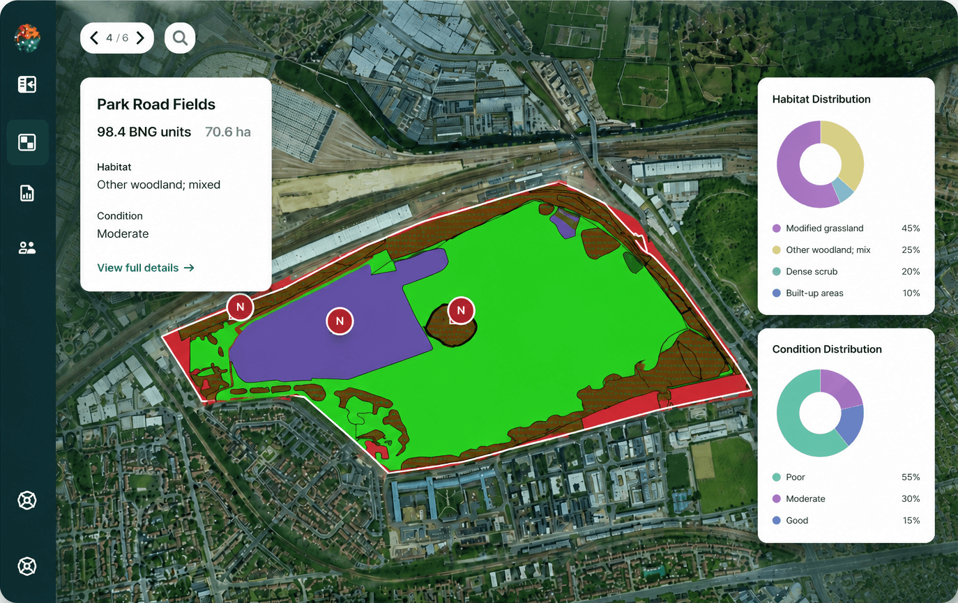
The risk map gives you an always-current view across your entire land portfolio — parcels colour-coded by risk level and confidence. Not a static report you receive once a year. A live system of record.
Built for decisions, not just data
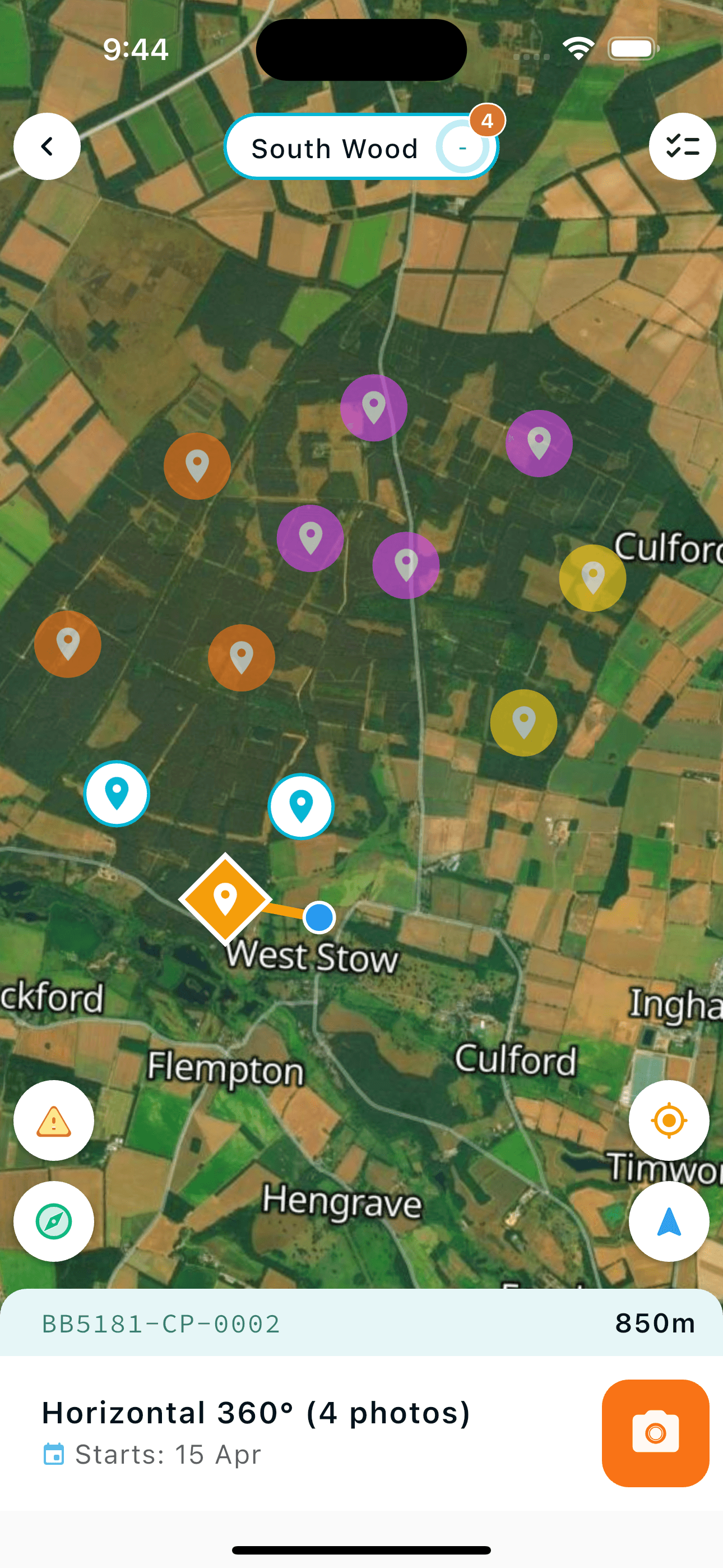
Democratisation of data collection
Guided smartphone surveys require zero ecological training. Your own field operators, land managers, and in-house teams collect audit-grade data immediately — no external contractors or specialist ecologists required at this stage. Expert ecologists focus only where they're needed.
Modality-agnostic infrastructure
Fuses satellite imagery, guided field surveys, IoT sensors, and drone data into a single unified system of record. Ingest everything. Standardise everything.
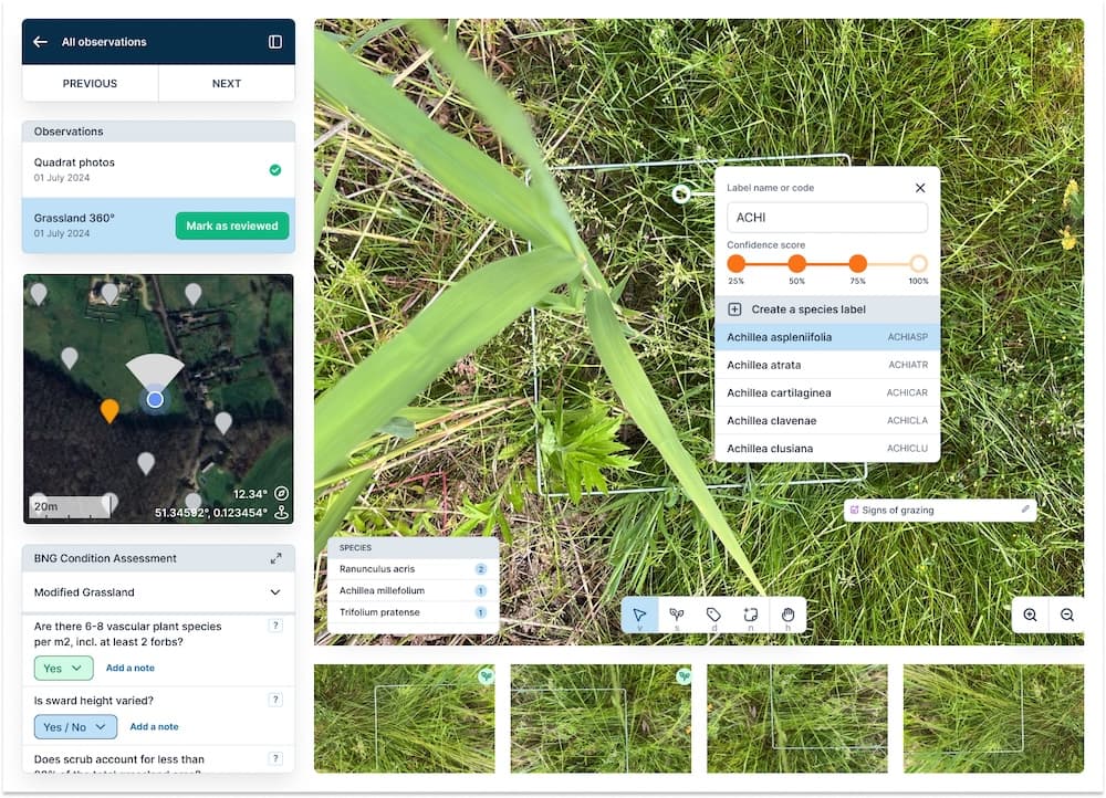
Remote expert verification
Our network of ecological experts remotely reviews site data at 10× the speed of an on-site visit. Every risk score carries an auditable evidence chain.
Multi-disciplinary risk intelligence
AI agents mine satellite and field data across ecological, hydrological, vegetation, and environmental risk dimensions — predicting risk before it becomes a liability. Risk scores roll up across your entire portfolio, ranked by severity and confidence.
From scalable data capture to decision-grade insights
Scalable data collection
- Deploy guided smartphone surveys in hours — no training required
- Fuse satellite & ground truth into a unified system of record
- Sensors, drones, and other modalities integrate where needed
AI-powered analysis
- AI agents mine satellite and field data across ecological, hydrological, vegetation, and fire risk dimensions
- Remote expert review provides assurance at 10× on-site speed
- Risk scores roll up across all sites — ranked by severity and confidence
Decision-grade output
- Act now — High risk, confirmed → Intervene and deploy capital
- Monitor — Medium risk → Keep watching, allocate budget
- Defer — Low risk, well-assured → No action needed
Auditable evidence chain for every risk score & decision
Right-sized assurance for every site
Each level triggers the next only when the data demands it. Organisations monitoring thousands of sites get portfolio-wide coverage without spending a fortune on every site.
Continuous satellite and EO monitoring. Portfolio risk scores and change alerts for every polygon, at all times.
Cost: lowest · Coverage: 100%
Smartphone or drone missions by field staff or community operatives. AI-processed geolocated field evidence.
Cost: low · For: high-risk flagged sites
Ecologist review via Mozaic verification interface. Audit-ready habitat assessment at 10× the speed of traditional surveys.
Cost: moderate · For: compliance-critical
Expert physical visit, deployed selectively. Full formal ecological report for capital decisions that demand certainty.
Cost: highest · For: capital decisions
Meet Moz — your AI nature assistant
Moz is embedded directly in your insights dashboard. Instead of digging through spreadsheets, ask your site data questions in plain language and get instant, data-backed answers.
Ask about site condition, canopy cover, invasive species risk — and get specific, traceable answers grounded in your actual data. The first step toward a fully autonomous nature assistant.
Where remote sensing falls short, Mozaic delivers
See the platform in action
Book a 30-minute call tailored to your portfolio and industry.
Book a call →